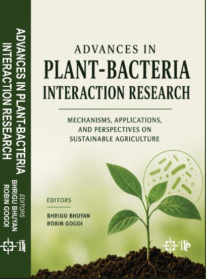
Agriculture · Plant Pathology
Advances In Plant-Bacteria Interaction Research
₹2,695.50₹2,995.00
Book details for Advances In Plant-Bacteria Interaction Research

Geology & Geography · Environment/Forestry
Advances in Geoinformatics is a basic text book on remote sensing GIS, Digital Image processing for all the students enrolled in the subject of Geography and Geoinformatics. Compared to other introductory text books, this book focuses on the up-to-date techniques of Geoinformatics. This book also provides an exhaustive coverage of optical, thermal and microwave remote sensing, global navigation satellite systems (such as GPS), digital photogrammetry, visual image analysis, digital image processing, spatial and attribute data model, geospatial analysis, and planning, implementation, and management of GIS. Earth observation (EO) satellites have already revealed their suppleness in providing data to a comprehensive series of solicitation in natural resource management. The 1st chapter of the book provides a comprehensive and basic concepts of Remote Sensing technology. Chapter II explore the basics of satellite imagery, its types and characteristics. Chapter III, presents the digital image processing techniques with advance image processing algorithm. Chapter IV covers the aerial photography and photogrammetric techniques. In chapter V, elucidate the basics of GIS and illuminates the fundamental basis of GIS technology, spatial data modeling, attributes data management, GIS data analysis, and modeling. Chapter VI highlighted the basics of geodesy and discussed the associated features used in Geoinformatics. In chapter VII, focuses on global positioning system and GNSS in details. In chapter VIII, emphasis and analyzed on the practical examples of Remote Sensing and GIS software. In chapter IX, encompasses various types of application of Geoinformatics with proper illustration and examples. Topics are covered with adequate tables and illustrations with an essential introductory part. Additional learning tools like maps, charts, figures and tables have been provided throughout the text. This book is very much useful as a basic textbook on Remote sensing and GIS for the professor, research scholar, and environmental science teachers, professionals, and for all the students enrolled in the subject of Geography and Geoinformatics, and for all entry level students enrolled in the educational programmes at the graduate and post-graduate level and for several skill building short diploma and certificate courses.
Advances in Geoinformatics Remote Sensing and GIS: Concept, Principle and Applications by Bhunia, G. S..
382 pages · English · Published 2021
Subjects: Geology & Geography, Environment/Forestry
Dr. Gouri Sankar Bhunia involved in Remote Sensing and GIS field for last 12 years. He has completed his Ph.D. in disease transmission modelling using remote sensing & GIS from the University of Calcutta (West Bengal). He is experienced with mapping with multiple database and working on multiple National and International projects simultaneously. Expertise in advanced satellite image processing, knowledge of Smart city Project 3D Modelling, Urban utility mapping, urban planning, Base map preparation, property assessment survey, hydrological modelling, Organic carbon concentration mapping and modelling, Disease transmission mapping and modelling, digital soil mapping, geo-chemical analysis, environmental data analysis hazards risk management, vulnerability assessments, change detection analysis, and land use planning. He has published several papers in prestigious International and National journal and three books with an International Publishing group. He is also a part of several Editorial Board of National and International Journal.
Dr. Uday Chatterjee is an Applied Geographer with a Post-Graduate in Applied Geography at Utkal University and Doctoral Degrees in Applied Geography at Ravenshaw University, Cuttack, Odisha, India. He has contributed various research papers published in various reputed national and international journals and edited book volumes. He has authored a jointly edited book entitled ‘Harmony with nature: Illusions and elusions from Geographer’s perspective in the 21st Century’ (with Prof. Shubhra Chandra). He is the Life Member of 08 academic societies of repute. He has delivered 07 invited lectures in University Grants Commissions (UGC) sponsored national seminars and various academic departments of different colleges in India. In addition, also, he presented 18 papers in national and international seminars/conferences held in India as well as chaired and cochaired more than 5 technical sessions. He has successfully guided project dissertations to undergraduate students. He has also conducted (Convener) one Faculty Development Programme on ‘Modern methods of teaching and advanced research methods’ sponsored by ICSSR. His areas of research interest cover Social and Human geography, Applied Geomorphology, Hazards & Disasters, Environmental Issues, Land Use, and Rural Development. Currently, Dr. Uday Chatterjee is an Assistant Professor in the Department of Geography, Bhatter College, Dantan, Paschim Medinipur, West Bengal, India.
Dr. Gopal Krishna Panda is Emeritus Professor in Geography and former Chief Executive of the Population Research Center at Utkal University, Bhubaneswar. He has teaching and research in the area of Coastal Geomorphology, Remote Sensing, climate change, natural hazards, and disaster management focusing on program evaluation, capacity building, and value addition. He was the Gold Medalist in post-graduation from Utkal University and a visiting fellow of the Liverpool University availing British Council Fellowship. He was the Principle Investigation for a major researchp reject sponsored by the UNDP and OSDMA to prepare the “Odisha State Natural Hazards and Disaster Vulnerability Analysis and Risk Assessment Report’’ for the state of Odisha. He is one of the advisor of ICZM program of the Govt. of Odisha. He has written and edited 6 books of which important ones are Eastern Ghats of Odisha, Flood hazards of India, Environment, Resource, and Development – A Geographical Perspective, Heat Waves in Odisha. He has worked for many natural and international agencies like WHO, UNDP, DFID, and public sector organizations like OSPCB, OSDMA.
�Remote Sensing Concept, Components & Function. �Satellite Imagery: Types and Characteristics. �Digital Image Processing. �Aerial Photography & Photogrammetry. �Geographic Information System. �Basics of Geodesy. �Global Positioning System (GPS). �Practical Example of Remote Sensing & GIS. �Application of Remote Sensing.
Agriculture · Plant Pathology
Agriculture · Plant Breeding and Genetics
Geology & Geography · Environment/Forestry
Agriculture · Botany · Biotechnology

Education & Psychology · Agriculture Extension/Rural Development

Agriculture · Botany · Medicinal Plants/ Flora/ Pharmacy
Agriculture · Botany · Medicinal Plants/ Flora/ Pharmacy

Agriculture · Botany